The valley of the Únětice stream and Roztocký háj are affected by the influences caused by their location. These nature reserves are located in the north of the capital city of Prague near the Václav Havel Airport, from where the water from the site, together with the Únětice Brook catchment, is directed to this location.

Project introduction
The project, which is supported by the Prague-Suchdol Municipality, monitors the behaviour of the Únětice stream level through sensors and a data platform. In the long term, the plan is to create a comprehensive measurement network to collect data on the contribution of individual fourth-order catchments to the behaviour of the Únětice Brook. Monitoring also includes the collection of temperature, relative humidity and atmospheric pressure data at the measurement site.
The solution used
In order to collect this data, it was necessary to use equipment with a long battery life and with data transmission via radio technology with sufficient coverage, because the location where the sensors are located is in a place where radio transmission is not optimal. At the same time, it was necessary to optimise the communication scheme of the sensors in order to reduce the power consumption and thus extend the monitoring time of the site.
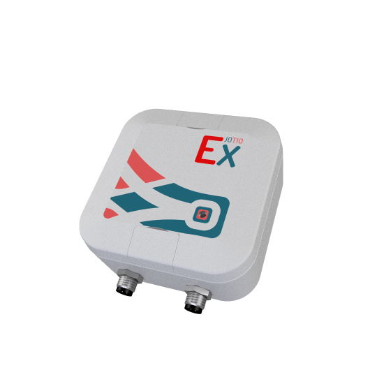
Pro řešení tohoto požadavku bylo použito zařízení využívající technologii LoRaWAN. Na základě předem stanovených instrukcí je optimalizováno komunikační schéma tak, že zařízení provádí měření častěji, než data odesílá. Zároveň samostatně data vyhodnocuje a provádí základní statistické operace, jako je například minimální, maximální nebo průměrná hodnota měřených dat. Výhodou tohoto řešení je snadná konfigurace a aktualizace zařízení prostřednictvím mobilního telefonu nebo notebooku přímo v terénu, a to pomocí technologie Bluetooth. Vzhledem k obtížným rádiovým parametrům v údolí potoka není možné v tomto případě využít alternativní způsob konfigurace prostřednictvím sítě LoRaWAN.
The following image shows the web interface of the application, which provides different views of the information and data captured, such as a map view. It is also possible to make the necessary service settings, parameterize the alarm function, or create an organizational structure with different permission levels. By default, the user does not need to check the platform, but is notified automatically if necessary. At the same time, incidents are registered, graphically visualized and logged.

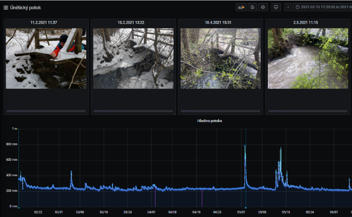
The following figure shows an example of the output of the acquired data. The graph shows the individual fluctuations and changes in flow levels caused by rainfall.

The obtained data can be used for the analysis of the situation in the monitored area. For example, the Geographic Information System (GIS) can be used to link data layers and create analyses of the impact of precipitation on stream levels. Combining these factors with the built-up area and the associated water retention capacity of the landscape, complex analyses on water in the landscape can be formed.

Currently, the project is in the initial phase to test the feasibility of the project. At the same time, consultations with the mayors of the surrounding municipalities are underway regarding the possible placement of additional sensors within their cadastre. The project is completely open to potential interested parties or other partners.
